The Dead Zone: Salton Sea

I like going to places and photographing areas that most wouldn't consider, the "non tourist" traps so to speak, places that will give me something interesting to photograph, learn and write about, so when I found out about Salton Sea it was added to the list.
Salton Sea is located about 2hours outside of LA, although we drove from San Diego along the Mexican border and up to it (also around 2 hours). It is America's largest inland sea, is 226 ft. below sea level and its surface area is 362 square miles. It was created over the course of 18 months when the Colorado River burst and flooded the area, but that is not what makes this place so interesting to me.
During the 1950's and 60's the area became a tourist hotspot, "a miracle in the desert", it was coined as being the new Palm Springs with beaches. Naturally real estate boomed and motels sprang up as half a million people flocked to the area per annum. Land was being traded at ridiculous prices, often without even being seen. The Beach Boys, Jerry Lee Lewis and the Marx Brothers were frequent visitors to the Northern Marina, but the bubble was to burst.
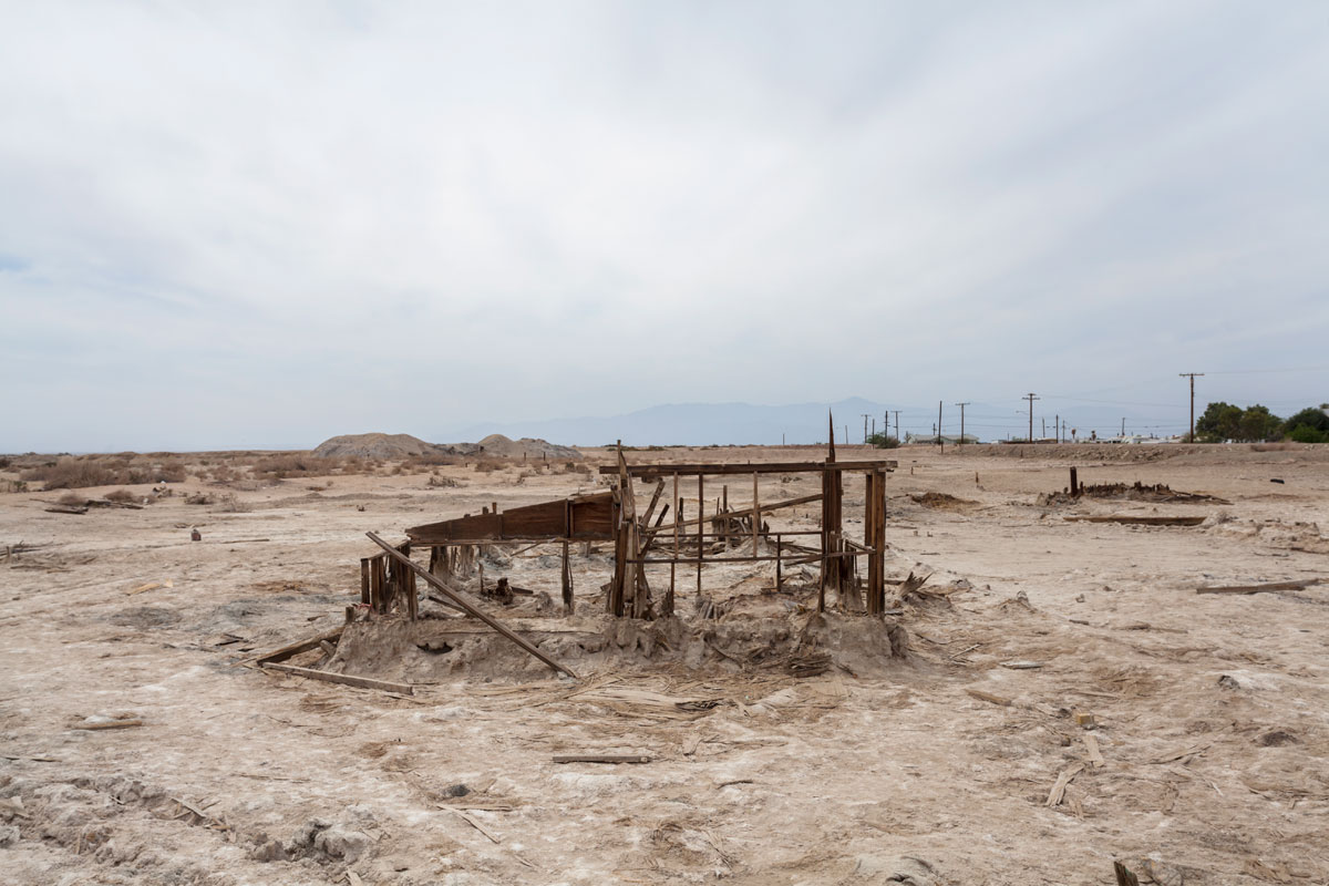
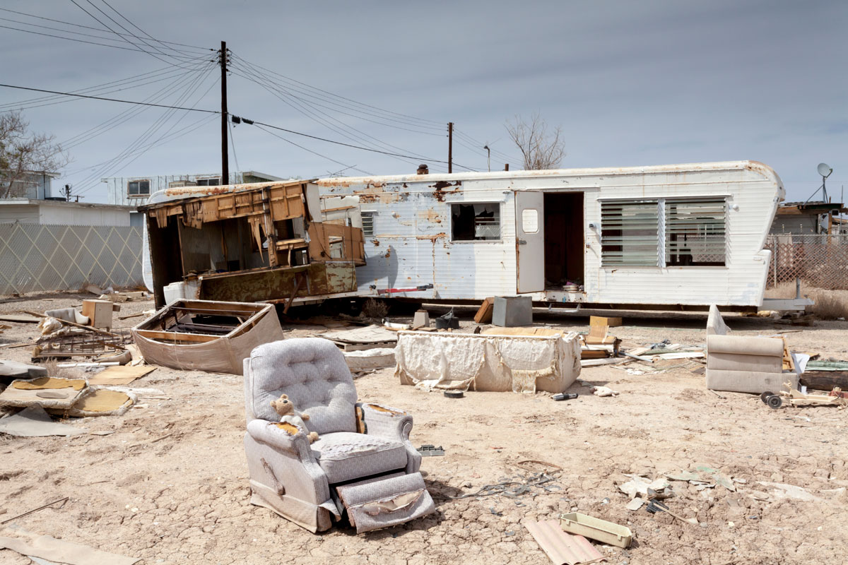
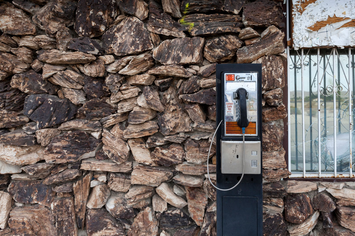
Much of Salton Sea feels apocalyptic in nature. Areas of residence, crumbling, abandoned and melting into the ground. The sea, now a murky colour that washes dead fish up on to the shores, the sand isn't sand, its fish bones and barnacles, if the heat doesn't hit you, the smell will! The stench is extraordinarily bad and there are camper vans, old sofa's clothes, TV's, piles of fridges, all smashed up beyond repair all disappearing into the hard, "bouncy" mud crust you walk on. And what caused all this? There seems to be many theories; the mixture of agricultural land run off and salt, a deadly combination of toxins that polluted the water with algae seems to be the most prudent. And then the floods came, much of the shoreline was left devastated; gas stations vanished into the sea, buildings crumbled, people and wildlife fled.
We only managed to get around an area called "Bombay Beach" (on the Eastern Shore) after 2 hours of walking round, through, between the buildings that remain, time was slipping by fast before we needed to take the 2 hour drive back to LA, Salton Sea requires a lot more time. However bad this area seems to us, people are still living here. In amongst the ruins, the unbearable heat and smell, there is a small community. While I shoot an abandoned caravan a guy watches on from his above ground "dipping/swimming pool", some gent rides his disabled motor cart down the empty, dust riddled streets, while on the beach a music video is being shot, it is a fascinating place.
I believe the South Shore was a military base, although from various sources, I now read it occupies a lot of people who want to "vanish" and live peaceful lives away from the hustle of city life: it has been dubbed "Slab City" and hosts an abundance of rather interestingly painted rocks! Happily the Northern Point looks like it is fairing much better than Bombay Beach. Wildlife and plantation is in abundance, a National Park occupies a large part with various hiking trails, beaches and RV parks-it has become an important wildlife spot for migrating birds. It has been cleaned up considerably and looks as if investment is going back into this area although there are still a few abandoned sites along the way.
If you are looking for something a little off the beaten track, aren't worried about bad smells, intense heat and abandoned buildings than this is the place for you. It's almost Route 66 in nature, slightly sad, very interesting, deserves to be rescued/preserved and is part of the great American History.
Below is a selection of shots from Bombay Beach.


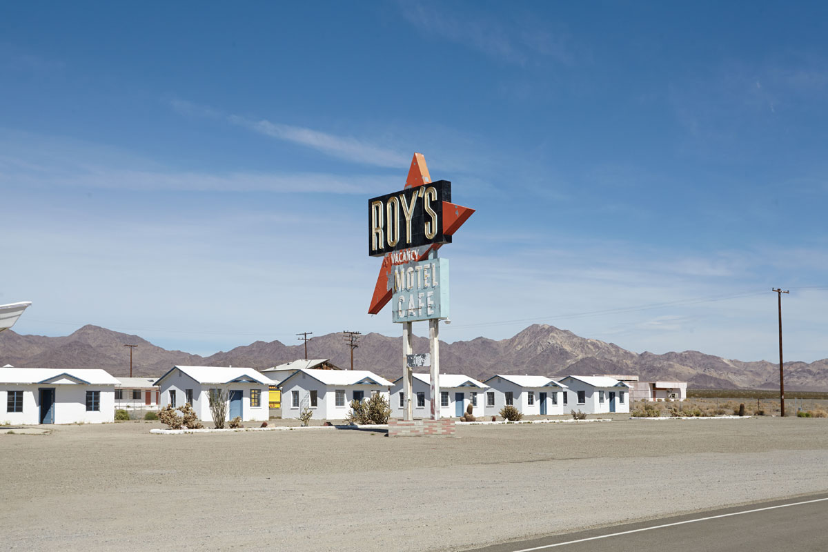
Getting our kicks, on Route 66
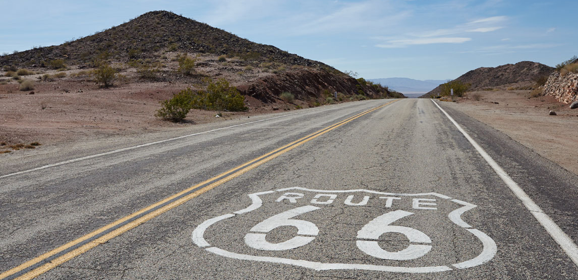
Route 66, or "The Historical Route 66" had to be driven, we couldn't be on a road trip without hitting the legendary road immortalised in verse by Bobby Troup. For a road it has quite a history, originally know as the Will Rogers Highway it stretched across country from Chicago, Illinois to Santa Monica, California covering 2448miles. Over the years and with thanks to the new interstates, traffic went elsewhere and large parts of the route declined, renamed and moved.
Many associations were set up to preserve the route and In 1999 Bill Clinton signed a National Route 66 Preservation Bill, which provided $10 million to various states to persevering and maintaining historic places along the route.
We had driven two parts, the first which we picked up in Kingman had various "new looking" diners/road signs and led us to Flagstaff, Arizona but contained little else, except a wonderful shop which was decorated with old signs and used cars and a superb German/American diner which served great burgers! The second part was the "old" route which we accidentally stumbled on after deciding to get off the freeway to LA and detour to Joshua Tree. This part of the route was magic and equally sad, the old 66 sign had been spray painted on the road at various points (to stop theft of the road signs) and there were various old buildings spread throughout. Gas stations, motels, houses, they were all there laying empty, decaying, many with graffiti from passers by marking their own journey. At the turn off to Joshua Tree lay a wonderful gas station, diner and motel with the typical Americana neon sign and style all In tact-and that's where we left.
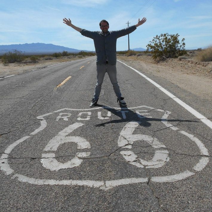
There's something about this road that conjures up wonderful emotions, driving window down, listening to the "Route 66" radio station, miles of empty road ahead of you. It's historical, beautiful, sometimes sad but still one of the greatest drives ever.